(+/-) Current Flow
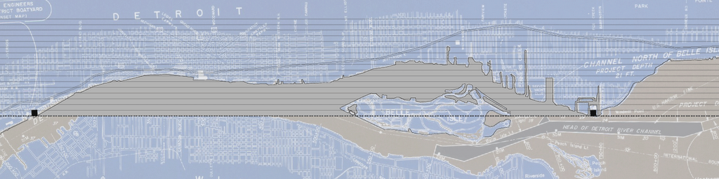
- Mapping the geometrical conditions is under way...it is the relationship to the edge and current of the metropolis that seems to be missing.
- Thought on the mapping of the water levels...in my previous research i came accross an investigation by the Urban Land Institute that related to the abandonment of low-income areas for the development of the middle to upper-income areas. This date i am not sure of, however it seems possible to use this type of shift in conditions that drove many to the edges of the city...(Negitive current flow)
- Now for the (Positive Current Flow)...what event along the rivers edge brings the greatest flow of humans to water?...The International Fireworks...
- So, with these two events in mind, it seems possible to chart the water levels during these specific dates and relate them to the social conditions.
- We need to find specific dates that we can deem "positive & negitive currents" that allows for the water levels graphs to be studied against the social conditions of that time.
- What were the river levels at moments of Detroits cutural "gathering"?
- Can we choose events? Are there other ways to relate time into this investigation?
posted by brian @ 4.6.06
![]()
![]()

0 Comments:
Post a Comment
<< Home